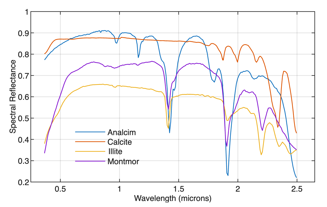
Digitizing from the Screen – the Python Version

On-screen digitizing is a widely-used image processing technique. While practical digitizer tablets exist in all formats and sizes, most people prefer digitizing vector data from the screen. Examples of this type of application include the digitizing of river networks and catchment areas on topographic maps, of the outlines of lithologic units on geological maps, of landslide distributions on satellite images, and of mineral grain distributions in microscopic images. This chapter was not included in the first edition of PRES because of problems developing cross-platform Python code for digitizing images. These problems seem to be solved now, so a Python variant of minput can be presented here.

Continue reading “Digitizing from the Screen – the Python Version”

Digitizing from the Screen – the MATLAB Version

On-screen digitizing is a widely-used image processing technique. While practical digitizer tablets exist in all formats and sizes, most people prefer digitizing vector data from the screen. Examples of this type of application include the digitizing of river networks and catchment areas on topographic maps, of the outlines of lithologic units on geological maps, of landslide distributions on satellite images, and of mineral grain distributions in microscopic images. The chapter on digitization is Section 8.7 in the MRES book. Here is an updated version of the section for use with MATLAB.

Continue reading “Digitizing from the Screen – the MATLAB Version”

Quantifying Charcoal in Microscope Images Using MATLAB, Part 2

Quantifying the composition of substances in geosciences, such as the mineral composition of a rock in thin sections, or the amount of charcoal in sieved sediment samples, is facilitated by the use of image processing methods. Thresholding provides a simple solution to segmenting objects within an image that have different coloration or grayscale values. As an example we use thresholding to separate the dark charcoal particles and count the pixels of these particles after segmentation. Continue reading “Quantifying Charcoal in Microscope Images Using MATLAB, Part 2”

Adaptive Filters in Paleoclimatology – the Python Version

Paleoclimate time series are often very noisy due to the combined effect of low sedimentation rates, intensive bioturbation and small sample sizes (5-20 foraminifers). Adaptive filters may help to increase the signal-to-noise ratio of such time series where conventional methods such as fixed filters cannot be applied if optimal filtering is to be achieved, because the signal-to-noise ratio is unknown and varies with time. Continue reading “Adaptive Filters in Paleoclimatology – the Python Version”