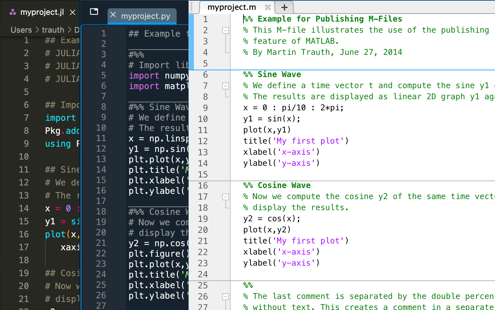
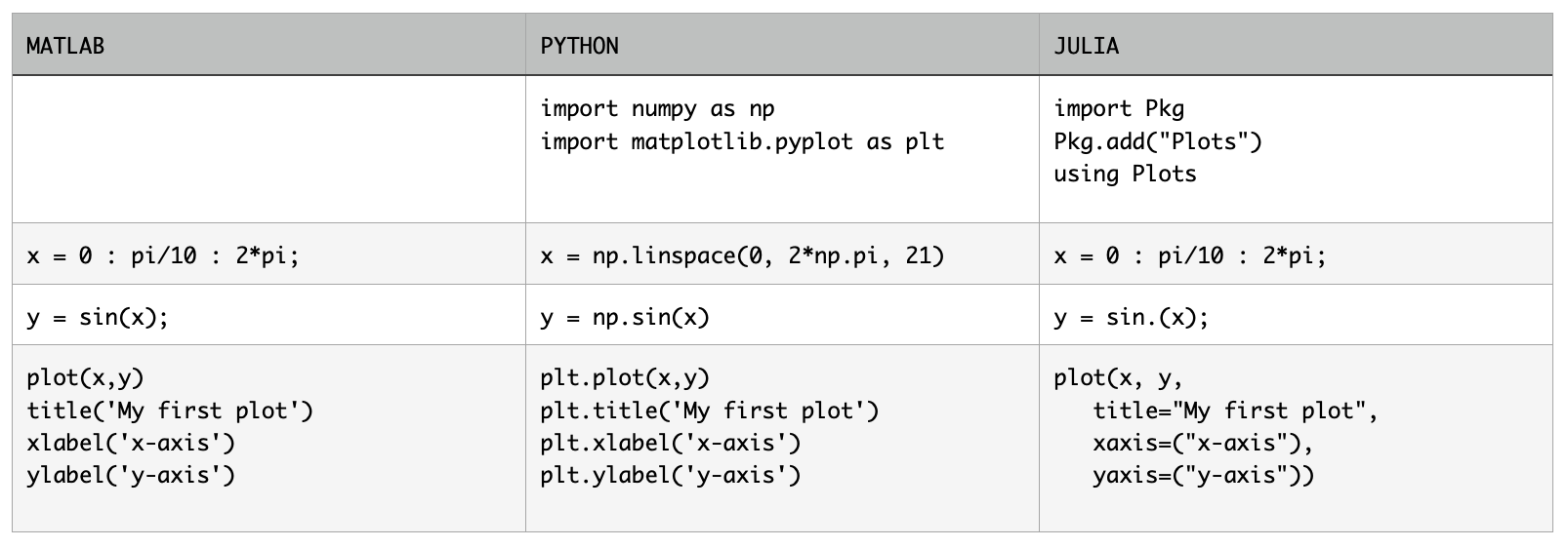
MATLAB Recipes for Earth Sciences, 5th Edition

The 5th edition of MATLAB Recipes for Earth Sciences now has a book cover and can already be pre-ordered on the publisher’s webpage. The picture on the top is a 3D display of a filtered SRTM elevation data set of the Baringo area in Kenya, showing fault escarpments and lake basins. The function surfl has been used to generate a shaded-relief map with simulated lighting, contour3 to create white elevation contours and the demcmap colormap from the Mapping Toolbox.

Dip and Dip Direction using Smartphones

The following exercise is intended to help to understand the measurement of the orientation of linear and planar structures in the field, using the magnetometer and the gyroscope of the smartphone. We will carry out a large number of repeated measurement, not possible with a traditional compass in a reasonable time. These repeated measurements will be statistically evaluated and interpreted with regard to their accuracy and precision.