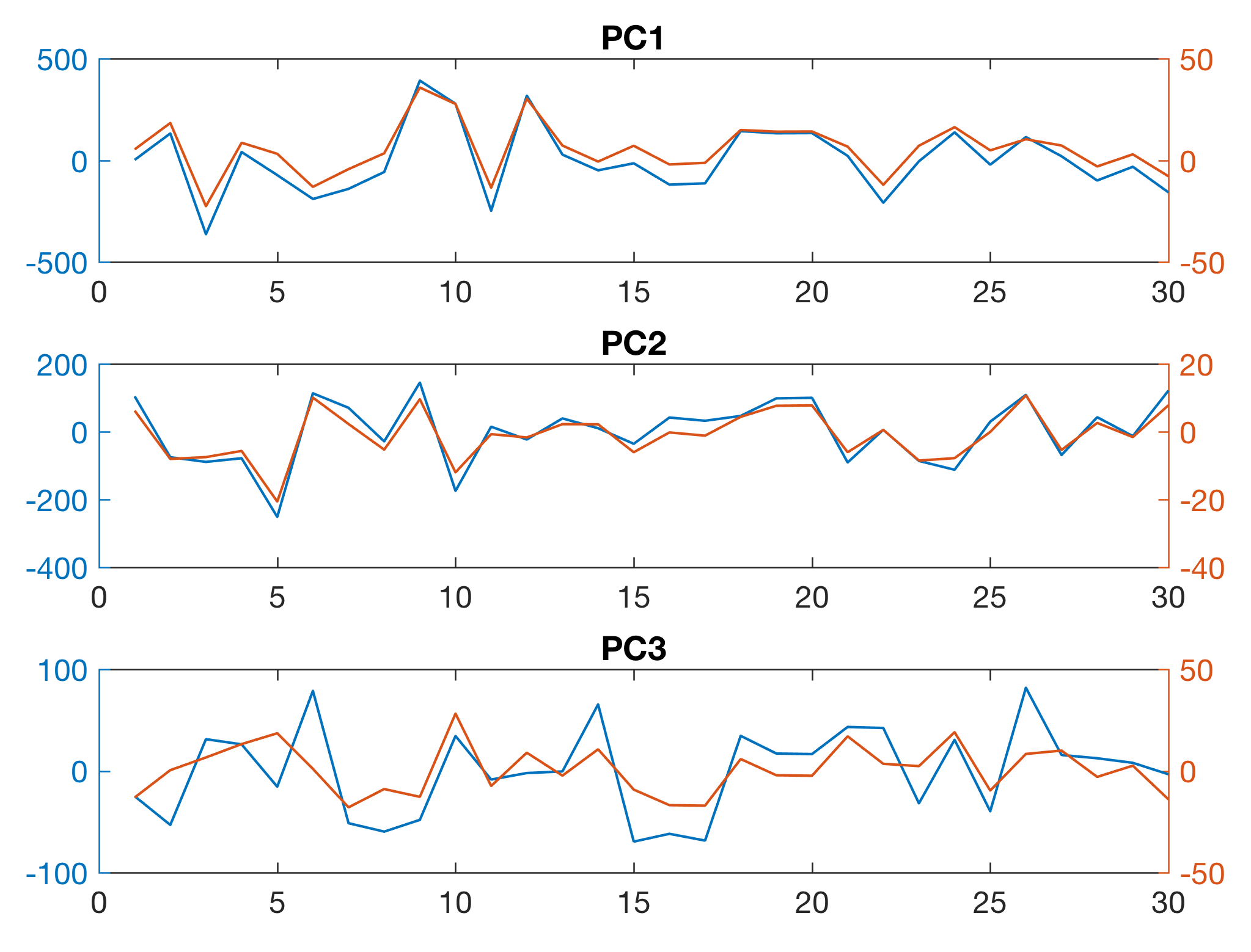
This exercise is intended to help students to understand how to scan the relative distance of a 3D object from an infrared sensor. The quality of the result, possible artefacts and sources of error are discussed in conjunction with the results of a previous exercise on the spatial resolution of the sensor. Continue reading “Object Scanning with MATLAB using the LEGO Infrared Sensor”
Object Scanning with MATLAB using the LEGO Ultrasonic Sensor
This exercise is intended to help students to understand how to scan the absolute distance (in meters) of a 3D object from a ultrasonic sensor. The quality of the result, possible artefacts and sources of error are discussed in conjunction with the results of a previous exercise on the spatial resolution of the sensor. Continue reading “Object Scanning with MATLAB using the LEGO Ultrasonic Sensor”
Missing Version History of MATLAB Functions [UPDATE: Fixed]
One of the really missing things in MATLAB is a version history of specific functions. As a MATLAB user for 25 years, I have a lot of MATLAB code that contains functions that have been modified, exchanged, or completely disappeared. I am mainly concerned with functions from the Signal Processing Toolbox, but this can also be due to the fact that I use this toolbox the longest. Continue reading “Missing Version History of MATLAB Functions [UPDATE: Fixed]”
The Apple iPhone/MATLAB Mobile/LEGO MINDSTORMS Scanner, Part 1
The Apple iPhone/MATLAB Mobile/LEGO MINDSTORMS scanner is an essential tool of our course in acquiring, processing and analyzing typical data earth sciences. Continue reading “The Apple iPhone/MATLAB Mobile/LEGO MINDSTORMS Scanner, Part 1”
Determining the Spatial Resolution of the LEGO Infrared Sensor
This exercise is intended to help students to understand how to determine the impulse response sequence and the frequency characteristic of the LEGO infrared sensor. Continue reading “Determining the Spatial Resolution of the LEGO Infrared Sensor”
Automated Varve Counting Using A Fuzzy-Logic Algorithm
A fuzzy-logic based algorithm may provide a better way to detect annual sediment layers (varves) in digital images of sediments. Continue reading “Automated Varve Counting Using A Fuzzy-Logic Algorithm”
Determining the Spatial Resolution of the LEGO Ultrasonic Sensor
This exercise is intended to help students to understand how to determine the impulse response sequence and the frequency characteristic of the LEGO ultrasonic sensor. Continue reading “Determining the Spatial Resolution of the LEGO Ultrasonic Sensor”
Quantifying Charcoal in Microscope Images Using MATLAB, Part 1
Quantifying the composition of substances in geosciences, such as the mineral composition of a rock in thin sections, or the amount of charcoal in sieved sediment samples, is facilitated by the use of image processing methods. Thresholding provides a simple solution to segmenting objects within an image that have different coloration or grayscale values. As an example we use thresholding to separate the dark charcoal particles and count the pixels of these particles after segmentation. Continue reading “Quantifying Charcoal in Microscope Images Using MATLAB, Part 1”