
Since the Apple iPhone Pro has an infrared LiDAR built in, geoscientists have presented a variety of possible applications. One of the most attractive applications is the scanning of outcrops.
LiDARs (Light Detection and Ranging) is a method to determine the distance between the device and an object with a laser. The combination of a LiDAR with an RGB camera and sophisticated software can be used to scan objects in three dimensions. The near-infrared (NIR) LiDAR sensor in an iPhone operates using a laser with a wavelength of around 940 nm.
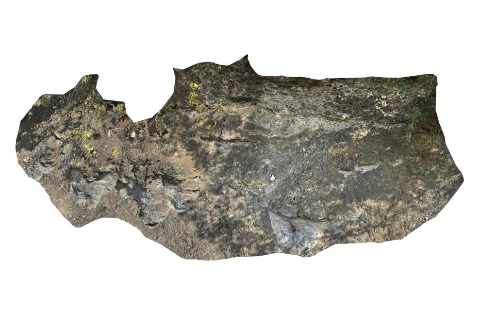
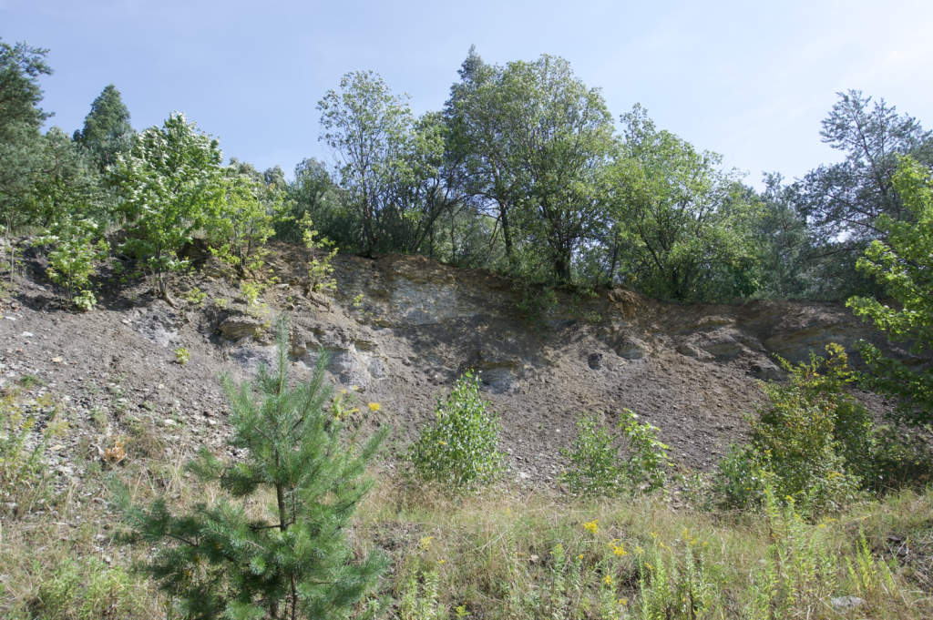
In the summer of 2023, we visited the clay pit of the Ziegelei Raum (50.861547°N 14.027569°E) in the Elbsandsteingebirge in Saxony, not far from the city of Dresden, where shallow marine sediments from the Cretaceous period are exposed. The outcrop has long been one of the stops on an excursion for first-year geoscience students at U Potsdam.
There we made 3D scans with an iPhone 14 Pro. For this we used the excellent software Scaniverse available for iOS. When scanning, ensure that a maximum distance of ~5 meters is maintained between the iPhone and the outcrop. The scanning process is carried out by moving slowly along the outcrop, with the software displaying the segments that have already been scanned and combining them into an overall image.
The 3D scan can be saved and exported in various formats such as PLY or USDZ. The result can be viewed with all standard 3D viewers. For example, a USDZ file can be viewed with the Apple Preview programme and the scan can be rotated and zoomed with the mouse. A screen video can be viewed here, for example. Alternatively, the PLY file of the scan can be loaded into MATLAB, for example, by using the following script:
clear, clc, close

I1 = pcread('iphone_lidar_sachsen_vs1_small.ply');

pcshow(I1,...
   'AxesVisibility','On')
set(gca,'View',[-37.5,30],...
   'ZLim',[0 5]);
daspect([1 1 0.5])
In contrast to Apple Preview, the gaps here are not filled by the RGB image, but only the points of the point cloud coloured by the RGB information are displayed. Instead, the representation in MATLAB has a coordinate system and you can therefore work quantitatively with the point cloud. Alternatively, you can view the 3D scan using
viewer = pcviewer(I1);
The amazing accuracy of the iPhone LiDAR is the subject of many blog posts and technical articles (e.g. Stauch, 2022; Luetzenburger et al., 2024). Especially during the COVID-19 pandemic, coinciding with the introduction of the first LiDARs with the iPhone 12 in 2020, many applications were created. As an example, LiDAR scans were used with virtual tours with 360° cameras such as the Ricoh Theta to create virtual excursions.
The 3D model of the outcrop can be viewed and downloaded in USDZ format from Sketchlab:
Downloads
A rotatable view of the model can be viewed and downloaded on Sketchfab.
References
Luetzenburg, G., Kroon, A., Kjeldsen, K.K., Splinter, K.D., Bjørk, A.A. (2024) High-resolution topographic surveying and change detection with the iPhone LiDAR. Nat. Protoc. 1–22. https://doi.org/10.1038/s41596-024-01024-9.
Stauch, G. (2022) Smartphone-supported mapping of landforms – A new tool in teaching geomorphology. Erdkunde, 76. https://doi.org/10.3112/erdkunde.2022.03.06
Trauth, M.H. (2021) Signal and Noise in Geosciences, MATLAB Recipes for Data Acquisition in Earth Sciences. Springer International Publishing, 544 p., https://doi.org/10.1007/978-3-030-74913-2.