Lake-Balance Modeling Using MATLAB

In a number of publications, we used a simple energy-based lake balance model to estimate precipitation and evaporation during highstands of paleolakes in Argentina and Kenya. The highstands were reconstructed from radiocarbon-dated paleoshorelines of landslide-dammed lakes and closed-basin rift lakes. Here we publish the MATLAB code to estimate the evaporation over land surface and water surface, which is the core of the lake-balance model used in our research. Continue reading “Lake-Balance Modeling Using MATLAB”

Calculating the NDVI From Multispectral Camera Images Using MATLAB, Part 2

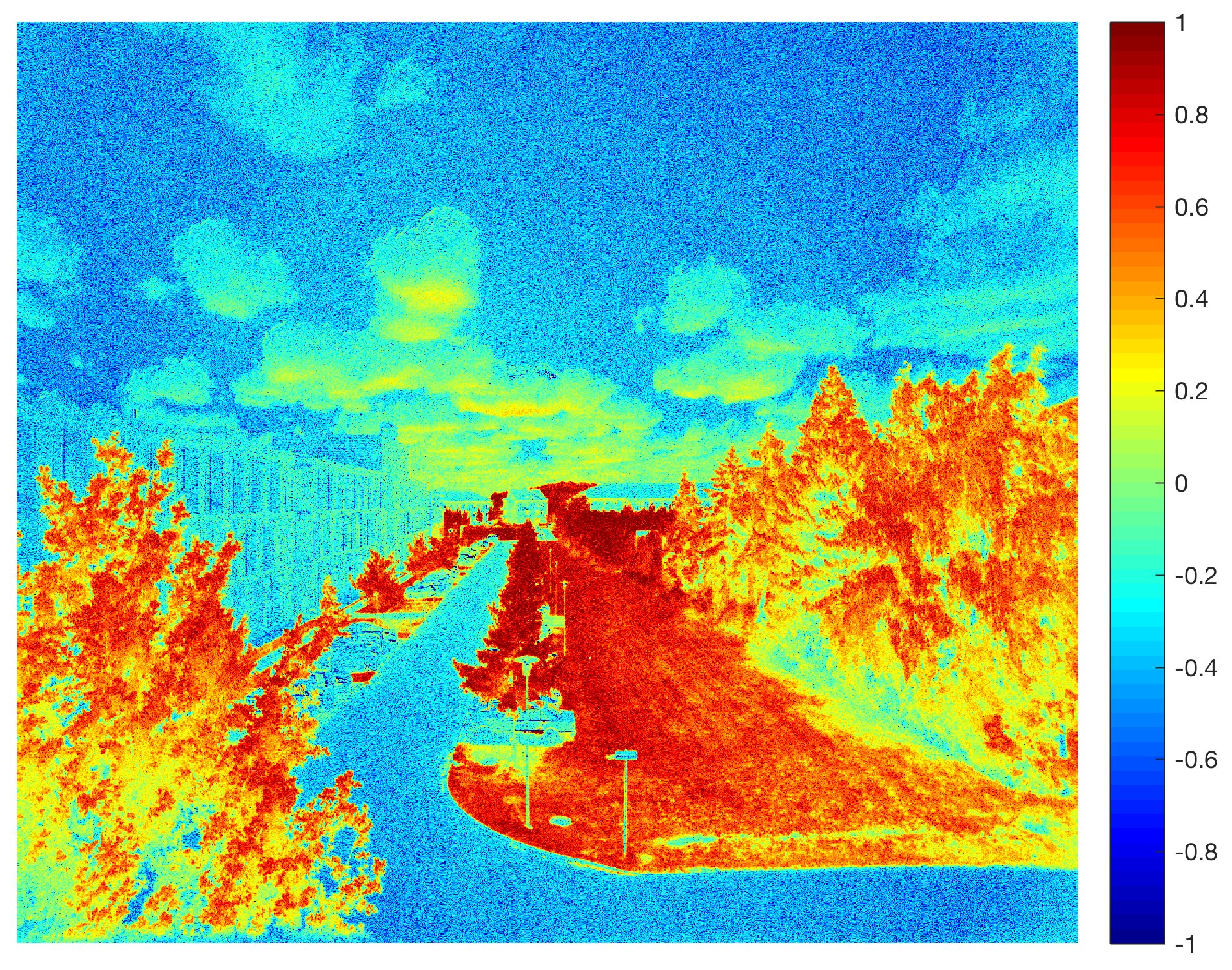
In an earlier post in March 2017 I explained how to capture NDVI Red+NIR images using a MAPIR Survey2 NDVI, to import the images into MATLAB and to calculate the Normalized Difference Vegetation Index. Here is the result of the experiment repeated in June 2017 during the growing season. Continue reading “Calculating the NDVI From Multispectral Camera Images Using MATLAB, Part 2”